
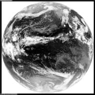
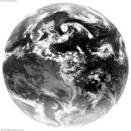
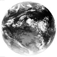
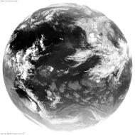
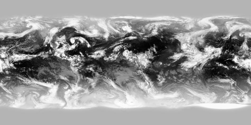
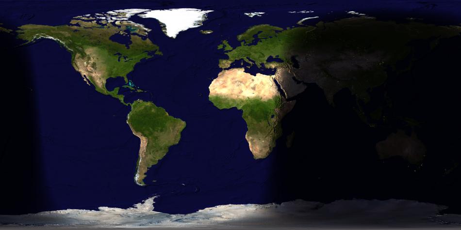
Dundee satellite receiving station
has a meteosat receiver and decoder - meteosat also transmits the other geostationary
satellite images which it gets by various means. The images from Meteosat,GOES-EAST,GMS,GOES-WEST and
IODC are joined
together with the most heanous of algorythms which get rid of the seams niceley
[they also fudge the poles, where geostationary satellites can't see and which
the russian sats no longer see]
 |
 |
 |
 |
 |
| GOES-WEST at 135W | GOES-EAST at 75W | Metosat at 0E | IODC at 63E | GMS at 140E |
 |
||||
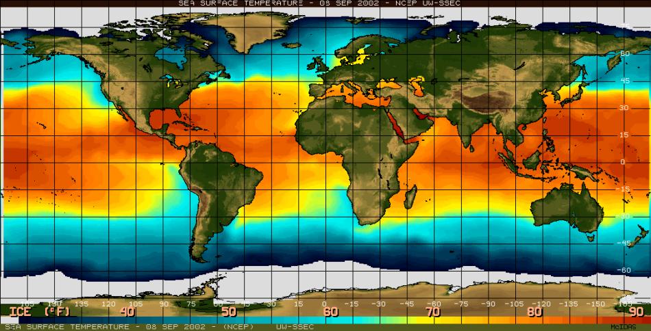
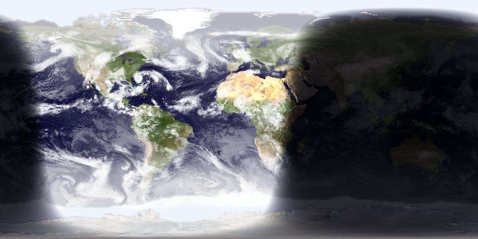
University of Wisconsin-Madison space
science and engineering center uses a variety of sources to generate
a daily sea surface
temperature dataset which I use too decide where the polar sea ice is
[they have poor coverage at the south pole so I have to fudge that as well].

NASA's
earth obvservatory has a project called blue marble [whose goal is to
do this at much higher resolution and in less realtime] they have an excellent
dataset of the earth's surface colors - they've even done the reefs correctly.
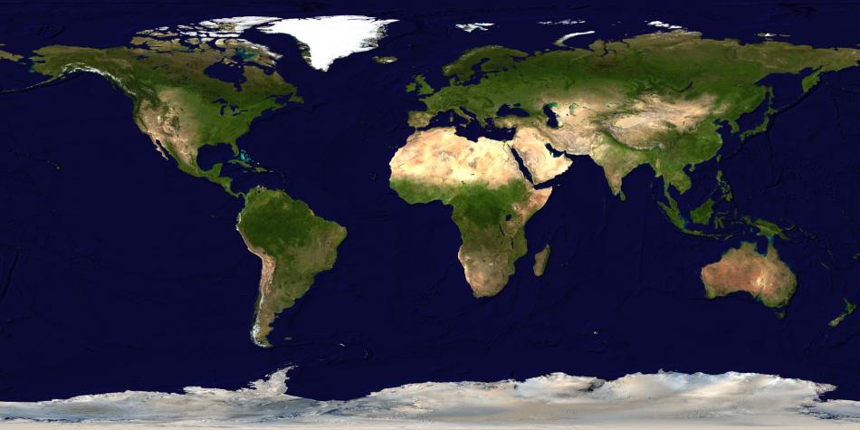
The NGDC
furnished me with a copy of ETOPO5 which has so many contributors it's impossible
to list them here. I use this to determine the shading for the earths surface.
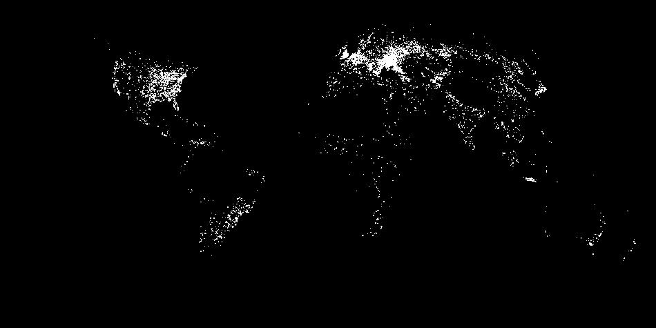
The USGS has a land usage dataset which I used to generate lights for the major cities [although this a little fanciful and way to bright - you can't see any man made lights (except nukes) when the sun is switched on] a nice other person did this bit for me.
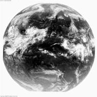
This lot is put together to give a map of the earth now
Then it's projected to the "view from space" coordinate system, finally LaTeX renders me a nice jpeg and an image map which goes on my homepage.
There's a cgi version that'll give you a picture of anywhere but it's
nowhere near secure so you can't access it
unless you happen to be in the Bullard
Laboritories end of the Department
of Earth Sciences of the University of
Cambridge.
Bugs and possible improvements:
James - August 2002